Gulgurn Manja Shelter (pronounced Gulkurn Manya) is a popular attraction tucked away just 5 kilometres from the western Highway and within The Grampians National Park.
Its proximity to the Hollow Mountain camping grounds makes it a favourite for campers spending some time within the park.
Gulgurn Manja Shelter, Rock Art Walking Trail, Grampians Victoria
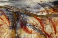
These paintings played a critical role in the cultural practices of the community, mainly because it was used to pass on the artistic style from one generation to another. This form of storytelling is, in part, one of the reasons why the cultural heritage has been preserved for years. The age of the paintings is not known; however, some rock shelters in the region have been aged at over 22,000 years old.
When visiting the shelter, you’ll also see several human stick figures, as well as animal tracks. But what makes this shelter stand out is that it’s situated within a sandstone outcrop, which is mind-boggling when one thinks about what it’s like living here before the arrival of the Europeans.
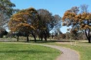
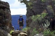
Gulgurn Manja Shelter is an exciting travel destination because to access it; visitors can take an easy self-guided 1km walk to the site. The trail begins at the northern end of Gariwerd. On the Western Highway, take a left turn once you get to Halls Gap Road. Look out for the signage that indicates Gariwerd Road on the left. A short distance away, you should be able to spot a sign that leads to the shelter. Take a left turn onto the dirt road until you get to the parking area. Make your way to the northern section from where the walking trail is well marked.
Maps may be obtained from Brambuk in the National Park, as well as the Cultural Centre Halls Gap. Alternatively, visit the local Visitor Information Centre to get a map and more details on the different attractions.
















Do You Have a Question to Ask?